Mapping the Balance between Imagination and Precision

My teaching colleagues and I–and here I’m counting parents among my colleagues–wanted students to grow into a sense of place that would begin local, and widen to the universe. We wanted that sense of place to be both intimate and informed: to have the tugging anchor of subjective personal experience; to have also the power and legs for traveling, the reliability, the sense of responsibility, of objective information and understanding.

For me, these different flavors in my sense of place come together in maps. That may be partly because of the ways I’ve experienced their use. In an early memory, my mother introduces me to our new house, not yet built, by telling a story using the blueprint: “Here you’ll come in the door, and here you’ll put down your lunchbox…” In a slightly later memory, we use a map of the world, posted on the kitchen wall, to trace our father’s travels.

map array with pinsWanting to give my students what had meant so much to me–especially at the beginning of every year, when they particularly needed sense of place–I filled my classroom with maps at every scale. Needing more wall space, I put maps out in the hallway, like a party spilling over. Showing someone a map, for me, is as happy as giving someone a book.

Maps choose what to show, and fall short of the truth by leaving things out, sometimes with intent to deceive, but often because there’s no escaping it. Realtors’ maps aren’t likely to show the things nobody wants to live near, the incinerators and Superfund sites–but every map on a local scale has to choose which tiny streams to signify with a blue line, and which to leave unknown, secret to everyone except the kids who play in those woods or that back lot.

mapping black and white aerialAn aerial photograph lies, too. For one thing, it flattens. In my classroom an aerial photograph of the landscape around our school helped us locate ourselves in this place we shared, but gave no real sense of the sizable hills many of my students crossed to get to school. (The map above isn’t the one from my classroom. On that one the school wasn’t labeled, and people had to work a bit, using whatever clues they knew, to find it. If you’re at all familiar with that area, though, you know about the hills that have vanished in the aerial photograph’s view.)

mapping topo UptonTopographic maps show contour much better. Once students knew how to interpret all those swooping lines, they could observe how the rivers wound their way between the hills, along the low points; how the river stretched out and wagged around in flatter places, like the route of the West River just a mile or so from school, where it moves slowly through swamp.

We talked about latitude and longitude and the trickiness of showing a spherical earth on flat paper or a flat screen. All that map literacy helps kids make sense of maps, and appreciate their precision. Beyond that, though, we gave kids lots of opportunities to explore the correspondence between a map and the world it shows–lots of chances to line up the street view and the overhead view; the labeled and boundaried with the geographic and unbounded; the subjective and the objective.

For starters, we posted combinations of maps and aerial photos on many scales. Here are a few:

  • a blueprint of the school, or the plan of the school on its property, compared with the Google image from overhead
  • the aerial view and topo view sampled above
  • a satellite photo of eastern Massachusetts posted near a highway map
  • the blow-up beach ball earth, that swirled blue-green-white marble the astronauts see, compared with the traditional globe in its wobbly frame (which always reminded me that the political earth is fragile and precarious.)

mapping beach ball globemapping river recording 2b
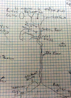
In projects time, we mapped the small watersheds our models created, in the sandbox or in a shallow tub of diatomaceous earth.

mapping Andrea and stone wall bWith Andrea Kendall, we clambered around on the hillside near school, finding the southwest end of a stone wall that could be seen on the aerial photo extending hundreds of feet back up into the woods.


Our Places Max 2b
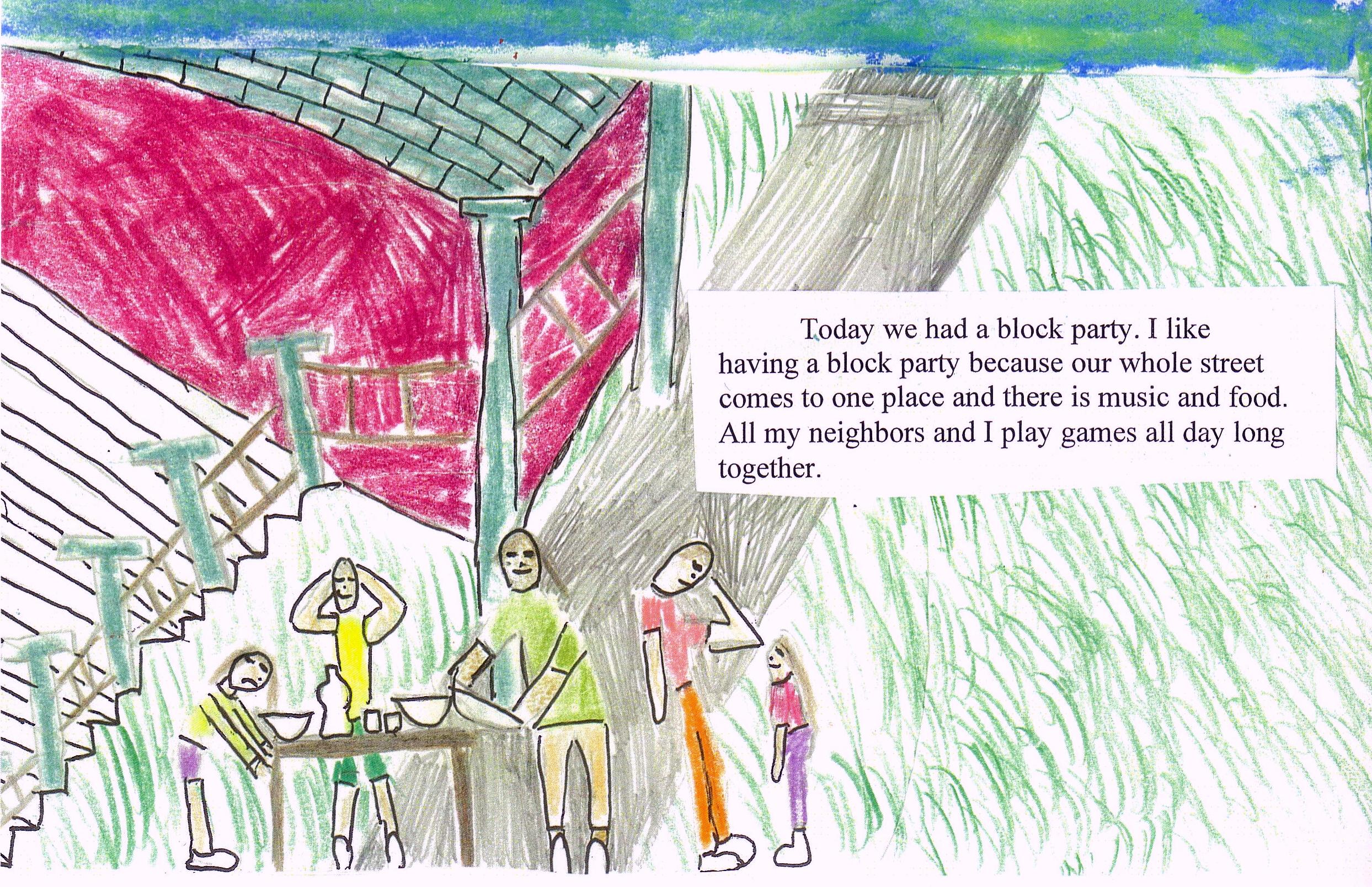
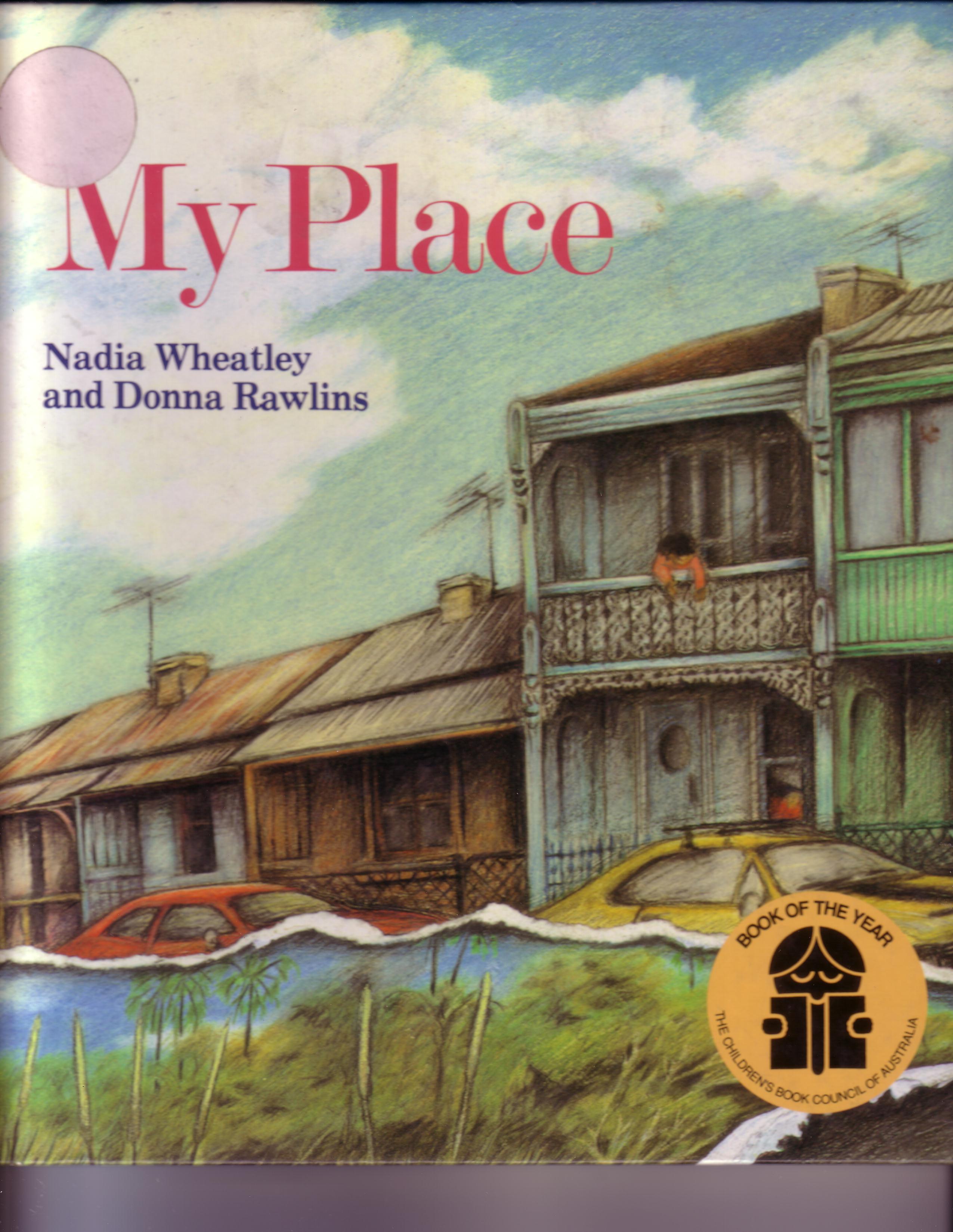
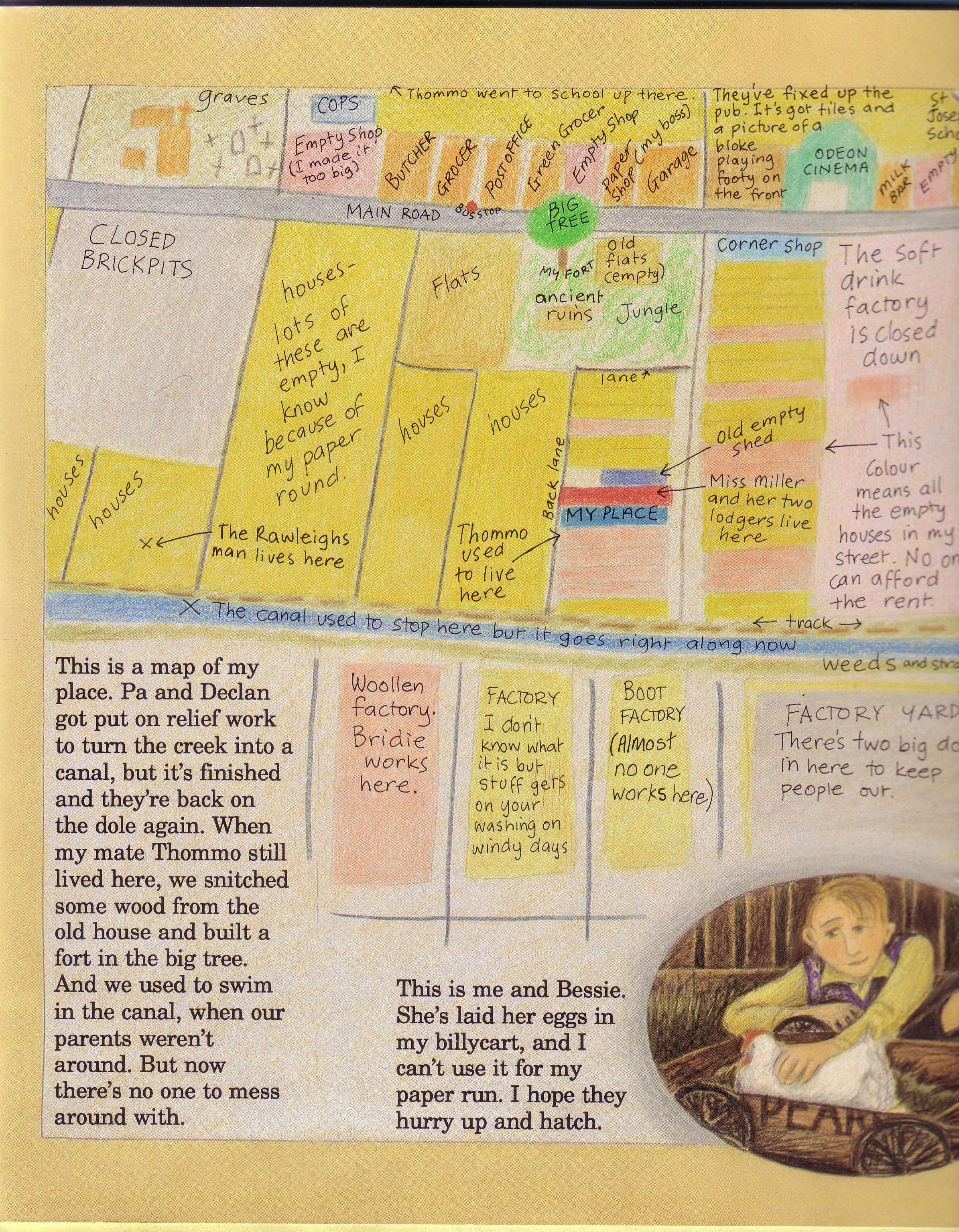
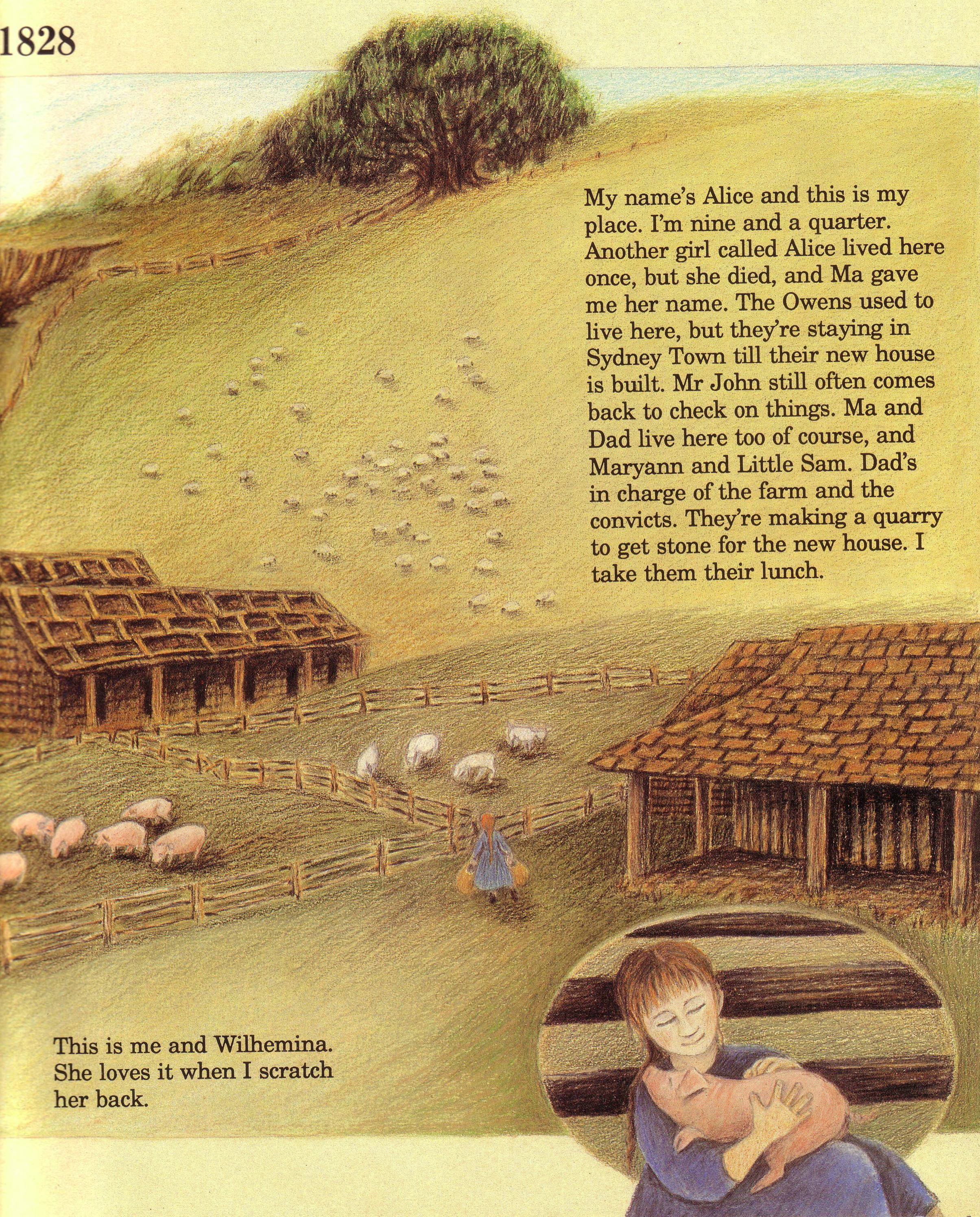
We read Vera B. Williams’ Three Days on a River in a Red Canoe, and thought about the role of maps in that adventure. We made maps of our own places, emulating the kids’ maps in My Place, the remarkable Australian book about sense of place, created by Nadia Wheatley and Donna Rawlins. 

We put maps into field trip packets, so the kids, often riding with drivers other than their parents–and some of them a little nervous about that–could take control, in a way, and follow our route from highway to highway, from Grafton to Sturbridge or Lowell or Pawtucket or Cape Cod.

On the giant topographic map array with which we started each year, kids narrated their routes from home to school, or from home to a friend’s house. Kids who lived in two houses for parts of every week marked them both and looked at the route between them. Samantha Cook, now a grown-up, once said: “No matter what I want, it’s in the other house.” Don’t all of us have something like that in our lives? The distances and relationships maps show us can be deeply personal, an objective correlative for a felt experience.

In general, whenever we compared a map and a place, using the one to help us understand the other, and vice versa, we were balancing, weaving together, precision and imagination, as all authentic human learning must.

Precision does matter. A map fails us if it isn’t as faithful as possible, and a gratuitously misleading map leaves us not just lost, potentially, but also with less power as citizens trying to take responsibility for our places. I’ve written elsewhere about a wonderful book by the Canadian writer Val Ross, in which she describes the lengths people have gone to in order to get increasingly accurate maps of the places that matter to them.

I thought of Val Ross last week, and wished again that she were still within the reach of earthly communication, so that I could send her an article one of my past students posted on Facebook–about the iconic outline map of Louisiana, black on white, shaped like a boot, found on signs everywhere throughout Louisiana.

mapping Louisiana

Throughout Louisiana, and beyond, that image of the state can be found–but not in the parts of the map that aren’t land any more. There, anything that could hold a sign–a post, a tree, the side of a building–is gone, underwater.

The altered map shows what Brett Anderson figures actually remains of Louisiana. He and his colleague Jeff Duncan want a truer public map, a truer icon, in order to focus public attention on land loss. The disappearance of Louisiana’s land results partly from natural changes, but it’s also an outfall of corporate actions, poor planning, political corruption–things that can be changed by active citizen involvement.

Active citizen involvement on behalf of place needs the nourishment of sense of place. It needs not just one good map or aerial view, but many, showing the present, showing the past, showing the hills and rivers, showing the town lines down the middles of the rivers, showing the connections.

I think of teachers in Louisiana, trying, as middle school teachers everywhere do, to use the increasing perspective and cognitive reach of that age, and help students see the relationship between the map and the world. I feel for all of them; we have a harder job when that relationship is broken.

mapping bike trail map editSo here’s a cheer for classroom maps, maps in books, maps posted out in the world, accurate and ready and waiting to be shared. The other day, my husband and I grinned at each other when we came to the end of our bike ride and saw two women standing at the large posted map of the trail. They were telling the story of the ride they’d just taken. “We parked here, and this is where we saw the swan, and this is where we stopped to talk with Joe–”

The map was helping them know their own lives more vividly and clearly. We all need that.

Afterthoughts, Afterlinks, Resolutions, and Thanks

My most recent post, about math mentors and math fun, was the 25th on this blog. The calendar year is about to turn; I’m a little less than halfway through my year to think it over. Time for a mixed salad of quick thoughts, including some resolutions.

More math fun

First, it turns out that 2013 is not prime. All year I’ve wondered. Finally, this morning, I started scratching calculations on the back of an envelope. Then I went to the web to double-check, and found a prime factor calculator. That confirmed it, just in time:

goofygraphics2013I also checked 2014. That, too, is a product of three primes, but I’m not telling. (You know right off the bat what one of those primes has to be.)

After reading the previous post, Kate Keller said some really nice things, including, “Wait! You left out the birthday ritual!”

Kate’s remembering something we did whenever a birthday happened in my class. I started by writing the child’s new age on the big whiteboard: 11, or 12, or occasionally 13. Then I’d ask, “What can we say about the number —?”

Students responded in a variety of ways:

  • with cultural uses of the number. (“It’s a dozen!”) (“Some people think it’s unlucky, but they’re crazy…”)
  • with expressions that equaled the number: 3 x 4 = 12, or 14 plus -3 = 11, or much more complicated expressions coming out of our experience with Lloyd’s Game (described in the previous post.)
  • with a magic number sequence that started with the number and returned to the number.
  • with words that describe other properties of the number: it’s odd (or even); it’s prime (or composite); it’s a palindrome; it’s deficient or abundant or perfect.

These various statements, written on the whiteboard, both documented learning and provoked it. Although we focused on the same numbers again and again, the activity was repetitive only in the way ritual has to be repetitive: a pattern similar in every iteration, but never actually identical; a shared dance in which roles can change and change again; a bowl or basket or web for both familiarity and innovation.

If I forgot to include the number ritual in our celebration of someone’s birthday, or if we ran out of time before dismissal, the kids insisted that it be carried over to the next day. Remembering my students’ affection for the ritual, and remembering the way every student participated, I feel like I’m holding some important key to who they were, and are; something hard to put into words; a treasure.

For still more math fun, check out the YouTube channel of Vi Hart. Here’s a link to one of my favorites, the first in a sequence of three about plants and the Fibonacci sequence. “Ow!” one of my younger students said. “My head hurts! Play it again!”

vihartfib

More My Place

I’ve been tickled to have the posts about My Place get a steady trickle of hits from Australia, so I did some behind-the-scenes backtracking. In the process, I found a wonderful collection of material relating to Nadia Wheatley, with an author interview, curriculum plans, and reviews of some of her other books–and a link to my own post about My Place, down towards the bottom. Great stuff!

If I were teaching right now…

I would read aloud The Higher Power of Lucky, the first in a series of three novels about a girl named Lucky in a town named Hard Pan, in the Mojave Desert.

higherpowerofluckyb

Living in a very small town, Lucky has memorable friendships with both kids and grown-ups. She eavesdrops on twelve-step anonymous meetings, hoping to hear the advice she needs. She hopes seriously for an afterlife, because there are some questions she would like to ask Charles Darwin. (She has a dog named HMS Beagle.) She’s cranky and impulsive and imperfect and worth a million dollars, and she’s part of a new sub-sub-genre of realistic contemporary fiction for young adults, in which characters think about biological evolution and what it means, and interact sympathetically with adults who can’t or won’t.

“If” thought # 2: I would figure out how a class could use the latest book by Alice Roberts, the charismatic anthropologist and medical doctor who narrates a BBC video series (which we did use in class) called The Incredible Human Journey.

alicerobertsevolutionbAlice’s new book (we pretend to be on a first-name basis with her, in my household), published by Dorling Kindersley, is called Evolution: The Human Story.  It uses narrative, model reconstructions, photographs, illustrations and charts, to take the print medium’s slower-paced (but thrilling) look at the history of our species, starting with the Big Bang. Such a rich resource for a class to use!

A third “if” thought: I would explore the idea of privacy, which matters a lot to 11- and 12-year-old people, and keeps coming up in the news.

Resolutions

One of my most faithful readers wants to know why I haven’t yet written about some teaching and learning that was central to my teaching life:

  • about the evolution of life in general, and about human evolution more particularly;
  • about animal behavior and archaeology and the history of technology;
  • about immigration, both chosen and involuntary, in the history of our country and our communities and families;
  • about Islam and the Arab world and the history of Arab Spain;
  • about The Voyage of the Mimi, both the first and the second;
  • and about the making of Voyage to the Sea.

Instead of writing about evolution, I guess, I’ve been evolving. (I know; I’m using the word in two of its different senses.) Somehow I’ve had to work up to those topics, and also work down with them. They’re all so huge for me, giant human artifacts around which I’ve spent all these years crawling, like an ant in the jungle, climbing up and looking around whenever I felt brave, or whenever a student was nudging me onward.

However, I’ve just made that list. I’ve included some of it sideways, in this mixed salad post. I’m pledging myself to figure out ways of exploring those giant thoughts in 1000 word packets, before my year to think it over is over.

I welcome, and probably need, suggestions from readers who shared those themes with me as student or parent or colleague or cheerleader. If you were writing this blog, how would you tackle all that big stuff? Just askin’.

In an activity so solitary (except for the joyful throng of co-conspirators in my memory), tiny encouragements from the rest of the world mean so much! A quick note in an email, a side comment in the aisles at Colella’s, a post on a website generated on the other side of the planet, devoted to a much-admired author–each of these remind me that I’m really doing this, and parts of it matter to other people. Some of you have recommended the blog, or a particular post, to friends and relatives and colleagues, or on Facebook; some of you have written comments on the blog itself, invariably thought-provoking, nudging me and lifting me forward. For all that…

goofygraphicsthanksRecently, my daughter has been sharing a website or movement called Lean In, which encourages women to lean into their ambitions, to overcome fears and take risks, with each others’ support. I take a big breath and “lean in” every time I publish one of these posts, and I’m inviting you to lean in with me, women and men (and girls and boys)–whatever that may mean for you.

My Place and Our Places

Last week, I focused on the book My Place, by Nadia Wheatley and Donna Rawlins, in which a series of child narrators describe the place where they live–always the same place, on the same hillside, changing as the book moves backward through Australian history. Each of the child narrators has his or her own sense of that same place.

What builds a sense of place, for any of us? What do we even mean by that? What can adults do to give kids a sense of place–or to stay out of the way of their process of developing one?

The book My Place inspired Our Places, a book created by one of my classes in the spring of 2010, when the kids with whom I had worked that year decided that they wanted to make their own maps of their own places, and put them together into a book.

We had discussed other final group projects, but this was the one they chose. “Only it can’t be different years, like My Place, because we’re all living in this year.”

“Just our different places.”

“And we’ll tell about the same kinds of things.”

Here’s a detail from Anwyn’s pages: Our Places Anwyn 1 detail

Pets

By “the same things”, the kids meant the motifs we had noticed in My Place, and then listed, common threads from child narrator to child narrator. For example, in both books, My Place and Our Places, almost every child’s place includes a pet.

Jose wrote about his dog, Clayton. Our Places Jose 1b detail

Other kids wrote about cats named Oliver, or Shelly, or Scout. One described a parakeet named Tweety. Our Place Isy 1b detail with Penny

Another wrote about her hen, Penny, who is “smarter than the other chickens and always bosses the other chickens around, even though she is the smallest.”

Parties

In both books, there’s always some kind of party. Luke lives in two separate houses with the two sides of his family. He decided to write about the place where he lives part of the week with his dad, in a section of Boston. Our Places Luke 1 block party

The detail below is from Caroline, who had already explained that her next-door neighbors were “almost like grandparents.” Our Places Caroline 2b party detail We didn’t coordinate which kinds of parties which kids would write about, but we wound up with an interesting variety: birthday parties, generic summer parties, a Halloween party, a Super-Bowl-watching party, a Fourth of July party with lots of fireworks, a Christmas party, and the gathering to send a big sister off to her prom.

“Some of the parties in My Place are for sad occasions, not happy ones.”

“Like Michaelis going away to Vietnam.”

“Or Thommo’s family getting thrown out of their apartment.” 

“Or there’s the time when the war is over, and some people cry because they’re glad the war is over, but sad that their boys aren’t coming home.”

“But that year’s kid walks on stilts and gets everyone to stop crying.”

Connections to the past

We talked about what the students could include that would be like the giant fig tree at the top of the hill in My Place, a landmark experienced and valued by every child narrator across a 200 year span.
Should the students each focus on some natural feature? They settled on just something old: an old tavern, the stone walls along which chipmunks and squirrels run, an old car, cemeteries, a big rock.
Our Places Dean 1 rock detail

 Freedom

Growing up in a time when some kids are asked to check in with their parents by cell phone as often as every half hour, my students had been interested in the way the My Place kids roamed all over their neighborhood or hillside, with and without permission. Although we hadn’t chosen it as a common thread, several students wrote about their range of freedom, and how that had changed as they’d gotten older.

For example, Abby described being allowed to bicycle further: Our Places Abby bicycling detail

Another girl marked in green the streets on her map where she was allowed to walk by herself.

Maps

These were sketch maps, like the ones in My Place, made to scale as well as kids could manage, but not based on detailed measurements. (That would be another project.) Here’s Abby’s map of her newly enlarged territory: Our Places Abby 2 map Some kids made their maps more accurate with the help of published maps, by tracing or just looking at an existing map or aerial photo to get a sense of relationships. Our Places Nate 2 map detail Like the maps in My Place, the student maps told parts of each child’s story. Our Places Max 2b

So what builds a sense of place?

A sense of place can’t require staying put. In My Place, the final narrator, an aboriginal child, says, “I belong to this place,” instead of “This is my place.” But the place shown is just one of several places where that extended family stays for different parts of the year.

What would it be like to stay in one place? Barangaroo’s grandmother says nobody would do that; it would be boring. For sure, though, Barangaroo has detailed knowledge and a strong emotional connection with that place.

When I moved to the house and neighborhood I think of as “where I grew up”, I had already lived in seven previous places.

Our Places Polly map detailMany of my students spoke in discussion about special summer places, or even, for one, a place she’d been only once, but memorably. I too had been strongly influenced by places where I’d never actually lived, including my Maine grandparents’ dairy farm, and my other grandmother’s urban lot in Brockton, Massachusetts, where I met the kids who lived on the street, and established hide-outs in the bushes.

Who knows? The sense of contrast between a variety of places may focus a child’s attention on the uniqueness of each place. Our Places Matt treehouse detailIn any case, here’s what seems to be more important than duration: a child’s active experience of the place. To bond with a place, a child needs experience of that place within some kind of freedom to explore, to take risks, to know a range of emotions, to act on a sense of possession. To grow her own garden and decide what to plant in it; to build a treehouse with his uncle, or a dam across the creek, or to follow the path across the brook; to create a little secret get-away under a wisteria bush.

Each experience becomes a tag, a label on the mental map the child is constantly creating, partly unconsciously. Each tag gets reviewed with revisits either physical or mental. Few kinds of learning more clearly deserve characterization as constructive learning, learning fitted together and made coherent by the learner; learning that constructs meaning instead of receiving it–in this case, meaning that is especially deep and nourishing.

I’m struck by the importance of peers in this process of place-bonding: siblings, or neighborhood pals, or cousins, or even rambunctious dogs–fellow explorers, with their own impulses and their own hesitations, often useful.

Time on one’s own matters also, and this is demonstrated in all my students’ equivalents of the hide-out in the My Place giant fig tree: their solitary bike rides, walks over to Dean Park, and charitable activities for ants.

On the other hand, for anyone who thinks that young adolescents don’t care about grownups: notice the importance of both parents and other adults, the next door sort-of-grandparents, the almost adult who babysits, the neighbor who takes all the kids for a ride in his old car, while everyone squeals going around the corners.

I loved how much I learned about each of these students, in the process of learning about their connections with their places. Teachers have to live with various kinds of grief, and one of them is this: it’s not possible to do every wonderful thing with every class. But I can’t help wishing I could have, and sometimes, in a group of adults, I have an almost irrepressible impulse to give them this assignment.

(Maybe some readers will comment with labels you would write on your own map, if you made one.) (Or with your own map.)

When we agreed to make the book, I said I would figure out how to send a copy to Nadia Wheatley. It took several steps of contact, and involved some suspense. Eventually, that summer, a package came back from Wheatley with thanks warmly expressed, and with a wonderful surprise: a DVD of episodes from the video series made for Australian television in the year of the book’s twentieth anniversary, with extra episodes to carry the story to 2008, exploring new dimensions of belonging or not belonging.

The video is wonderful, and does special justice to the book’s theme of transcending differences. Still, I feel as I often do about film adaptations of books I love: the book means more to me. It’s less about excitement, television style, and more purely about the role of place in our lives, the responsibilities a place can grow in us, and the ways sharing a place can connect us.

My Place

We’re sitting in the meeting area–not in the circle we use for meetings in which we all talk with each other, but in the arc facing my corner, that works better for read-aloud books with illustrations. For a larger class I would need to make a Power Point. The intimacy of leaning forward, leaning together into the world of the book, can work here.

In this memory, I’My Place Nadia Wheatleym reading My Place, a book created by Nadia Wheatley and Donna Rawlins, originally published in Australia in time for the bicentennial of their European settlement. One of my early class parents discovered the first U.S. edition, and donated a copy. (Most of the copies I’ve bought over the years have been from the later U.S. edition, from Kane Miller, who bring books from other countries to the States.)

After that first reading, one crop of kids have linked to the next, and students spending a second year in my mixed-age class have said almost every year, “You should read My Place again.”

As I begin to read aloud, puzzled faces remind me that the book can be confusing. Each year, reading My Place refreshes my appreciation for the full, rich range of interests and attention styles represented among my students. I’ve learned to trust them: they’ll get it, together.

My Place 1968 editThere’s the kid who always notices numbers of any kind, including dates. She figures out, already on the second two-page spread, that we’re going backwards in time. “Before it was 1988, now 1978. The next one will be 1968.” It is, and that year’s child narrator, Sofia, has posters of the Beatles on her bedroom wall. She writes about an older brother who’s a soldier in Vietnam.

That step to the side–to a history both different from our own country’s, and similar to it–lets us notice things we may have been programmed not to notice. Kids say, “So they were involved in the Vietnam War, too?” “Both countries were settled by waves of immigrants?” Eventually, “This stuff about how the Aborigines were treated–it makes me think about our own Indians.”

Always, at least one kid is especially interested in maps–visual records of things that stay in one place. He looks at the progression of child narrators’ maps, a new (older) one for each jump back in time, and he begins to imagine a similar map of his own neighborhood: how far from his house he would include in each direction; what scale he would use; what he would put in and what he’d leave out; what he would label, and what colors he would use for different kinds of buildings–all the decisions we’re meant to imagine the book’s child narrators making. (The map below is from 1938, which was a hard time in Australia, too.)

My Place map 1938 edit

Other kids make sure I read all the labeling on each map–partly because they’ve figured out that important clues are often embedded there.

Another kid is crazy about geography as lists and facts. She quickly picks up on the clues that we’re in Australia, something I try not to give away. Some years, we take this further: we use the detailed clues to convince ourselves that we’ve found the bay and canal near Sidney. (The map below is from 1838.)

My Place map 1838 edited

My Place 1898 railings and Miss Miller detail

Some kids are particularly able to pick up on detail in illustrations, and they’re the ones who say, “Wait! This is all the same house! Look at those railings!” Then we go back and compare, page by page: yes, yes, yes, yes.

My Place 1988 railings detail

My Place 1828 hillside cropped And for much of the book it is the same house–each child narrator is the right-aged child living in that place–until the house hasn’t been built yet, and we’re with the sheep and pigs, on that hillside, below the big tree, above the bay and creek.

In every class, some kids will have unerring radar for family relationships, They’re the ones who first point out that Sofia in 1968 is the unwelcome baby sister in 1958; or that the Miss Miller who is almost 90 in 1948 is the zippy aunt with the bicycle in 1898, and also the nine-year-old Minna who makes friends with a Chinese immigrant vegetable farmer in 1868.

My Place Minna and Leck recroppedBy 1798, almost the end of the book, everyone has learned to follow these connections through the book’s strangely inverted time. When 11-year-old Sam, indentured convict laborer, climbs up into the big tree and pretends that he can see all the way to Shoreditch and his mother and sisters and brother, the class grows even quieter. They know that he will become the Sam remembered in 1838 by one of his children, the father who has fallen off the rich landowner’s roof, and died.My Place last map detail

I don’t want to tell about the actual ending of the book; I want you to go find it and read it, and join all of us in the complicated feelings it generates.

My Place and Place Based Education

There’s a new name for something I’ve always tried to do as a teacher: place based education, arising out of the resources of a place, helping students develop a sense of place, helping students feel responsibility to their place and empowered to make a difference there. (If this sounds good to you, you should go find the wonderful books David Sobel has written to explore place based education and document its effectiveness.)

Nadia Wheatley and Donna Rawlins were also doing place-based education before it was named that. Clearly, they created My Place to help Australian kids know more about their country, and to encourage those kids to know their own local and particular places, their personal equivalents of the big tree that is a landmark for every one of the child narrators, or the canal that was once a creek, or the ridge where the main street was once a footpath. Because there are so many narrators, the place itself assumes unusual importance.

I’ve always been fascinated that their book’s strategy works for American kids, too. Immersion in this other place encourages kids to notice their own places, and I’ll write more about that in a future post.

It seems to me that Wheatley and Rawlins must have wanted something else, too: they wanted to show their narrators experiencing the local versions of big picture history: the pros and cons of the immigration experience; the hurt of economic injustice and waves of joblessness; the recurrent mercilessness of war, and the injuries and losses and dislocations left in wars’ wake; the environmental impacts of economic development, as we travel back to a time when it was actually safe to swim in the creek. But also kids’ perennial delight at new technologies: streetlights! personal automobiles! television!

Within all that big picture stuff glimpsed small and made real, Wheatley and Rawlins have shown us each child narrator’s way of assembling and creating his or her own experience out of what is available. We see all the different reasons for perching or hiding in the big tree. We see the comfort children find in animals, and the things that can be learned about each child’s adults from the parties they throw.

Always, in each new older time opened out for us, something has been lost; always, something has been gained. Each child narrator exists within the river of time, which gives and takes away. The book itself, its spirit, becomes that river, revealed to us in a special way by the authors’ device of making it flow backwards.

For just a minute, I want to address directly all those years’ worth of kids sitting in a series of meeting areas together, taking up the book’s back-cover challenge: THIS BOOK IS A TIME MACHINE! Again and again, you showed me details and connections I would have missed by myself. But also, in the deep and brave way you experienced the book and its place and world, you helped me feel what it all meant, and for that especially I thank you.

My Place Sam in the tree detailThere’s more to this story: the book’s wonderful success in Australia, and its transformation into a video series, brilliantly updated to the present; one class’s decision to make a spin-off book called Our Places. For various reasons, I’m saving those things for another time.