Chasing the River, Part 2

In a previous post, I described a student named David who decided to “chase the river”–more accurately the series of brooks and ponds and rivers–that carried his backyard runoff to the sea.

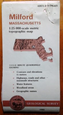
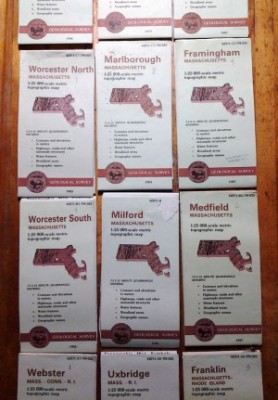
Many students after David found their own watershed pathways, working with the classroom set of topographic maps and other resources. Our distribution varied, from year to year, but we always had a fair number of students who lived in the school’s own watershed, the Blackstone River watershed, along with many from the Sudbury, Assabet, Concord and Nashua sections of the Merrimack watershed to the north, a few from the Charles River watershed, to the east, and a few from the Quinnebaug, to the southwest.

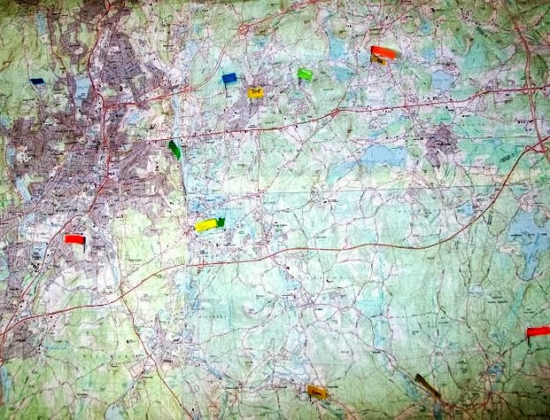
Kids had all sorts of adventures following their watershed pathways, naming nameless brooklets and ponds, asking helpful neighbors what they knew, and playing in the mud.

Once, when we were stumped, I made a house call. Marissa lived on the very top of a hill, typically a watershed boundary. According to the map, her front yard would drain into the Sudbury, and her backyard into the Charles. In actual fact, it all went into the street drains, whose outflow ran into a holding pond, whose outflow ran into the Charles. Not for anything would I have missed that rainy afternoon slogging around in rubber boots, peering down through street drains to be sure which way the water was flowing.

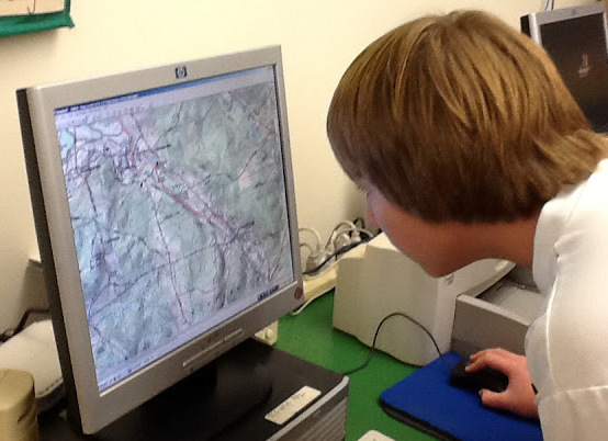
Eventually, with the help of other map freaks, I discovered National Geographic’s Topo software, which let a student use a mouse to trace a pathway on a seamless electronic topographic map, then printed for us the annotated map that resulted. So a student could start with the little trickle that ran across the back of her yard, and keep going, without even needing hip waders or bug repellent. (It’s a shame to miss that entirely, though, and most kids got both experiences: on the map and on the ground.)

Andrew working with Topo cropped

Once a student had done his electronic tracing, he could ask the software for an elevation profile, and see how his pathway was all going downhill, except for a lake or a pond–a long flat stretch–or a place where a hand twitched and the path climbed out of the river briefly. To trace a pathway from brook to pond to river, then flip that path and see it from the side, sliding down the edge of the continent—that was pretty cool.

tracing watershed pathway cropped

If a small group of kids did this together, squeals and screams might erupt from their corner of the classroom, applauding the kid who just kept “sailing” down Narragansett Bay all the way to the open Atlantic. The group above, working with Terry Lunt, parent volunteer extraordinaire, is following the unfamiliar path of a classmate who lives way out in Charlton.

Kids who shared the lower part of their pathways, what they called “the big river,” could meet together and see, for example, how much area was drained, by all their different routes, to become the power of the Blackstone, harnessed for the mills and re-channeled for the canal that gave the Blackstone Valley so much of its identity.

Then what? The maps and their pathways could be put up in the hall for the rest of the school to see.

Topo watershed printouts whole group cropped

Like a dare to everyone passing by: wherever you live, some story like this belongs to you. You can go find out, and you can get started with a map.

Some years, students created posters to share with each other and parents at a special watershed night. Some years, we were even more ambitious, ridiculously ambitious. At the outset of Touchstone’s Older Student Program–supported by a state arts grant and with the help of a wonderful video consultant, Veda Reilly–Katy Aborn and I worked together to create a multi-part video called Voyage to the Sea. Voyage included documentary sections about topics such as the water cycle and water power, as well as story sections about two teams engaged in a regional competition called The Blackstone Watershed Relay.

In the final chapter of the video story, Bill McHenry, then director of Touchstone’s Extended Day Program, posed as the director of the Watershed Protection Association, the fictitious nonprofit that sponsored the equally fictitious relay. Speaking to students who had become fired-up environmentalists as a result of learning about their watersheds, Bill repeated a quote from Bernie McGurl of the Lackawanna River Association, one of thousands of real-life organizations of people who have gathered together to learn about their watersheds and to protect the quality of the water flowing through them.

Water has a voice. It carries a message that tells those downstream who you are and how you care for the land.

Within those words, and within all these connected river-chasing experiences, there are lessons within lessons, like watersheds within watersheds: lessons about the ways learning is grounded and deepened and enriched by attention to place; lessons about everything that flows to us and everything that flows from us, and the responsibilities we share with others and to others; lessons about what we can learn from each others’ small views, flowing together to become a wide view; lessons about the power of the learning community.

If you want to get started on your own watershed adventure, here’s a good place to begin: http://cfpub.epa.gov/surf/locate/index.cfm 

Or you can just put on your boots and head out the door. Don’t forget the map!

Chasing the River

As a teacher learning along with my students, I met Donna Williams, watershed wizard at the Massachusetts Audubon Broad Meadow Brook Conservation Center and Wildlife Sanctuary. She told us that the word watershed means the area from which rainwater or snowmelt drains into a particular body of water. You’re always standing in a watershed, even if your feet are dry.

Watersheds are often split by town or state boundaries, complicating efforts to protect them. Before the Blackstone River could be cleaned up in any significant way, the watershed of the river, draining large areas of both Rhode Island and Massachusetts, had to get over those political identities, and some economic rivalries, too, and start thinking like a watershed, an area with a lot to gain by working together. Knowing about watersheds can help us understand both the organization of ecosystems, and the impact of environmental damage–and environmental improvement.

To make it even more interesting, we live in watersheds within watersheds.

When my hillside gets a heavy rainfall, whatever doesn’t soak into the ground runs downhill into one of several small brooks which braid together to be called Indian Brook. So I live in the Indian Brook watershed.

A couple miles downstream, Indian Brook runs up against a dam and forms the Hopkinton Reservoir, in Hopkinton State Park, which looked like this on September 18, 2013, at a time of low water and not much color yet in the leaves.

Hopkinton Reservoir cropped

After it emerges from the reservoir, Indian Brook twists and turns some before it runs into the Sudbury River, near the tracks for the MBTA train to Boston. Meandering through Ashland and Framingham, the Sudbury runs beside the Massachusetts Turnpike briefly, then heads north, through the marshes of the Great Meadows National Wildlife Refuge. In Concord, the Sudbury joins up with the Assabet River at a place called Egg Rock, to become—presto change-o—the Concord River.

This photo of Egg Rock was taken in 1904 by Alfred Sereno Hudson [Public domain, via Wikimedia Commons] from the very beginning of the Concord River, with the Assabet to the right, and the Sudbury out of sight to the left.

Egg_Rock_1904

By the time it gets to the Concord River, my backyard runoff is traveling with that of many of my past students, from Hopkinton and Southborugh and also from Westborough, Marlborough, Northborough, Sudbury, and Wayland. The story isn’t over, though, until we get to the ocean.

In Lowell, the Concord joins the Merrimack River, saying hello to a tremendous share of the runoff water from New Hampshire and central Massachusetts. Go check on Wikipedia: http://en.wikipedia.org/wiki/Merrimack_River, and you’ll see what I mean, unless someone takes the map down. Hundreds of thousands of people live with me in the Merrimack watershed. Of course, for a humbling comparison, you could check out how much of North America is drained by the Mississippi.

Anyway, back to New England, all these waters head for Newburyport and the Atlantic, shouting for glory as they go, especially in flood season.

Many explorations opened up this story for me: walking parts of my watershed pathway, canoeing other parts—swimming in some places!—and tracing all of it on maps.

Like so many explorations in my life, this one started with something a student wanted to do. For a big individual report, David Gelman wanted to ‟chase” his own watershed pathway. Here’s something interesting: although David and his family lived only a couple of miles from me, his pathway was completely different, and led to the Atlantic via Narragansett Bay in Rhode Island.

While everyone else was reading books, David and I sprawled on the floor to read topographic maps. Step by step we figured out which body of water led to which, using the topographic contour lines to make sure we were headed steadily downhill, the way water does. At the same time, we figured out all the places where roads followed, or where bridges crossed, the succession of brooks and ponds that led David’s backyard runoff to the Mill River and then the Blackstone River.

Armed with that information, David and yet another amazing Touchstone parent, his mother Rosemary, went adventuring, ‟chasing the river.” They managed to find almost every road crossing of their watershed pathway. At each stop they did simple visual tests for water quality, and took photographs. Their thoroughness was inspiring to everyone else, and deeply satisfying for them.

David wound up knowing something about his place in the world that I wanted more kids to have a chance to know–and more grown-ups, for that matter, beginning with myself.

This stream of thought (I couldn’t resist) could go on for quite a while–It would take much more than one blogpost to tell about everywhere that led. Think of your power, David, wherever you are!

Next time, finally, I’ll jump forward to the 2012-2013 year, when we were studying New England, and did some work with watersheds using Topo software. Down by the virtual riverside.

Mapping the community

One of my grandfathers died when I was not quite two years old. Photographs show me sober-faced and blonde on his lap—but I can’t consciously remember him. As I was growing up, though, I treasured stories about him, souvenirs, evidence of any kind.

I remember a wall covered with maps which my grandfather had joined together, to show a wide area of many towns centered around the Maine farm he and my grandmother bought in the late 30s, when the world seemed to be falling apart. To make this map collage, he had used USGS topographic maps, first bought (pre-farm) for fishing trips, for knowing the ways of brooks and ponds. Tiled together, the maps gave both a huge view, and detailed views–the paths of the largest rivers, and the wiggles of the tiniest brooks, all on the same wall.

Fast forward many years, during which I grew up in a house with more maps on the walls than pictures, and then married a man whose idea of unpacking, after a move across several states, was to open a box labeled MAPS in the middle of the night, and put up a good selection. The Pisgah National Forest on the bathroom door; a map of the known universe on the wall of the dining alcove. Etc. (Some other wife might have been less pleased.)

milford quad smallerFast forward again through several other kinds of work, and find me, eventually, teaching classes of kids from towns all over central Massachusetts and the northern corners of Connecticut and Rhode Island. I wanted to help them know where they were all coming from, and use that as a start for thinking about the worlds we didn’t share and the worlds we did.

It was my husband who said, ‟You could get a whole lot of USGS topo maps.” And it was my memory of my grandfather that said: in a classroom, there are really large walls.

For years, then, a new school year officially began for me when we put the maps back up.

map array smallerI arranged the array of maps, still folded, on a table, and then handed them one by one up to my husband where he stood, somewhat precariously, on a counter below the largest bulletin board space. I folded back the margins to the edge of the map itself; he worked to make the edges of the maps match up as well as possible, so that roads, in red, or brooks, in blue, or town lines, in black, wouldn’t stagger from one map to the next. We marveled again—him from two inches away, perched high; me from the middle of the room—at how much of our relatively urban state was still woods (in green) or swamp (stippled with those funny little swamp symbols.)

Enter students. I usually began, the first week of school, by encouraging kids to compare the map array with the satellite photographs hung nearby. Those big purplish splotches on the maps matched up with cities easily visible from space. The major highways, 9 and 90 and 495 and 290, showed as arteries on the satellite photos also.

But then we zeroed in. If their houses or apartments or condos weren’t too new, and if they didn’t live in downtown Worcester, kids could find on this public document a piece of their private lives: their homes, in the form of tiny black squares. We marked each student’s place with a flag pin specially augmented with page markers, to hold their names.

Here’s most of one year’s map flags:

map array with pins

The kids who lived at the top of the array, up near the ceiling, had to call instructions to a grown-up climber, but the kids down in the nether regions of the Blackstone Valley could stand on a low stool and place their own map flag, sometimes finding the pinprick left by an older brother or sister in a previous year.

Students who lived in city neighborhoods or new houses—or, oftener and oftener, as the years went by, on brand new streets—had to look carefully at nearby streets and intersections, tiny ponds back in the woods, the shapes of hills given away by topographic lines, in order to see and mark where their houses would be. Sometimes it helped to replay the trip home from school: and here we turn left, and that’s where the old drive-in theater is.

Kids whose parents lived in different houses generally chose to mark both. Parents came in during morning sketching, to clarify confusing locations. Other grown-ups wandered by, and pointed out their own landmarks.

As we traced routes between each others’ houses; as we figured out who lived furthest from school, and who closest; as we crossed bridges and followed off-ramps—all of us developed increasing fluency going back and forth between our knowledge of the three dimensional world, and the abstraction of a two dimensional map.

Like a story, a map shows relationships that we didn’t realize before; it also leaves out things we know better than it does. We need the map and the map needs us.

Next post, I think, we use maps to chase rivers. My grandfather would have approved. Andrew working with Topo cropped

The butterfly

John Hildebidle, a dear friend from my poetry life, wrote to ask, ‟What about the butterfly?”

Sheryl Erickson and Martin Fuchs gave me the butterfly, which is a kite, at the beginning of their daughter Sophie’s time with me.

It felt like an apt emblem for everything parents gave, year after year, to the life of the class:

  • the gossamer but tough, often hard-won strength of parents’ faith in our mission and methods;
  • the powerful, buoyant, transforming lift given by parents’ contributions of time,  patience, shared skills and new ideas;
  • the brightness of parents’ joy whenever students shared their learning– enthusiasm not just for their own child’s efforts but for every child’s.

That last one seemed especially apt. In classes before mine, Sheryl had put lots of volunteer energy into exactly that, to strengthen parents’ care for each others’ children.

I hung the butterfly high on the classroom wall, and waited to see what else it would mean for us.

butterfly smaller detail sharpenedFor some students, the butterfly was above all a rich collection of colors. During morning sketching, over the years, many students chose to draw the butterfly, reproducing all its shades and shadings with our markers or colored pencils, as faithfully as they could. In this way the butterfly multiplied and flew away, onto shelves and into closets, but also into hearts–the way things can, even when they seem to disappear.

Meanwhile, gradually, privately, the butterfly became a reminder for me, to try to be fierce in moderation, as wacky as that may sound. I had had teachers myself who cared enormously about their subjects or their students or all of it, as I did. I knew that to venture into a classroom with the passion I brought inevitably carried some risks. Day after day, I looked at the butterfly and told myself to breathe, to ask questions and listen, to have faith in the fullness of time. To try, as much as I could and when I could, for a light touch. Of course, I often had to forgive myself and start over, every day, as all of us must.

None of that was what I wrote back to John, because ultimately all of that combined with something more, and the butterfly became, in the words of my email to him, ‟a sort of guiding spirit for the classroom, encouragement to use whatever freedom we had, to be vivid and colorful.”

The life of a progressive school is full of determination to do the right thing, to ‟make meaningful things happen,” as one past head of Touchstone School, Steve Dannenberg, used to say. Teachers and staff, parents and grandparents, all carry a profound sense of responsibility: to students, to the spirit of learning, to the truth of the world. None of that intends to be grim–or fierce–but it can become so, as the things most important to us can.

Early in my teaching career, I explained to a friend that I felt weighed down by the incredible opportunity, the freedom, to teach exactly the way I believed. If I could do that, I had to do that, and I was getting very little sleep in the effort, straining too hard.

I can’t say that ever completely changed. Still, here’s what I’ve learned about freedom: We never have as much freedom as we want, for pursuing what matters to us–and yet we never actually use all the freedom we have. But there’s also this: the more earnestly we try to inhabit our freedom, the more we become like butterflies whose wings have grown too heavy.

So the butterfly kite is flying high on the virtual wall of my blog, to remind me that yes, I want to be true to many important things; yes, I want to make meaningful things happen, in what I explore and write about in this “year to think it over.” But I want to do that with the wind in my sails, with the wonderful colors of classroom life in my heart, with a grin and a whistle when that’s called for. With joy. manikin sharpened

As for the artist’s model with her arms spread wide, gesturing: it’s possible that you just had to be there.

Building Average

I’m here to confess: I’ve spent a good portion of my teaching career guiding students in freaking out the cleaning staff.

Each year, in Level 6 math, we built a model of the Average Student, statistically accurate, earnestly assembled, vaguely lifelike. We set it up in a chair toward the back of the room. Usually the students chose a book to balance on its lap. I myself sometimes entered the room, at the end of a long meeting after school, and did a double take.

Traditionally, we took a group photo of the assembled class, with the dummy. Here, for example, is an unusually small class, from the fall of 2010. (Clockwise from the top, Kelly, Ben, Seth, Anna, Lydia, and Gianna,)

average 2010 better

A few weeks post-portrait, when stray arms or eyebrows began to fall off and litter the classroom floor, we held a funeral, usually with dual caskets–since one cardboard box couldn’t hold it all. We paraded more-or-less solemnly to the dumpster, and gave heartfelt testimonials about everything Average had helped us learn–

–which was a lot. If you ask a typical adult what an average is, chances are you’ll get the series of steps followed to find the mean of a set of numbers: add up all the numbers; then divide by the number of numbers.

That’s not wrong, as directions. But what does an average really mean? What can it tell you about a situation or a set of data? What can it not tell?

MathLand­—a wonderful math curriculum no longer in print—gave Level 6 students a chance to explore the idea of ‟average” from the inside. Many years after we had shifted to another curriculum, I kept starting the year with this unit, because it was perfect from so many points of view.

Setting a goal

You could build an average kitten, or an average bookbag–but it worked really well to build an average math class student. Kids took it all more personally, and paid more attention to interesting questions: Is Average identical to any individual in the group? How does the model represent each person’s data?

MathLand provided a data sheet which included a variety of measurable attributes—such as the girth of the neck, or the length of the upper leg from the hip to the knee. The sheet also asked about attributes that had to be described in other ways—such as the color of eyes or hair.

Some questions were yes or no: Do you wear a watch most days? Some questions had been wisely left out. Average was always just Average, neither he nor she. We weren’t asked to measure around the waist, or chest, just shoulder to shoulder.

Some questions deliberately provoked discussion. How do you measure the length of the neck? From the bottom of the ear? From the hairline? The whole class had to stop and decide, together, or the data would be meaningless.

Gathering and recording data

Before we could begin collecting data, we had to choose an appropriate unit of measurement, and an appropriate degree of precision. I did specify metric units, partly because I wanted students to get some practice with decimal numbers. The kids agreed that the measurements had to be at least as precise as the nearest centimeter. Even that could result in very unrealistic hands, though; so we almost always wound up agreeing it should be to the nearest millimeter, which we recorded as a tenth of a centimeter. (Fertile fields, of course, all of this.)

Boys helped boys measure, and girls helped girls. All the data was kept anonymous—and we said that the study subjects were unreachable for clarification of messy handwriting, so the recorded data had to be both readable and reliable.

Working with data

On the other hand, the occasional inscrutable handwriting also offered a relevant opportunity, once we reached the computation stage: If you can only read the data for 11 of the 12 members of the group, what should you use to divide the total? What would happen to the mean if you divided by 12 instead of 11?

Also, once you got your mean, would it tell you anything about the huge variation in sizes of kids this age? No–only if you added information about the range, which wouldn’t actually get built into our model.

Could a very long-legged class member and a very short-legged class member cancel each other out? Yes, in effect. But in a class with several unusually long-legged people, would the mean probably be affected? Yes, again.

Meanwhile, what about the attributes described by words? For those, we found the mode, the most common answer or value, with interesting results. A math class with only 4 out of 13 blue-eyed students could wind up building a blue-eyed Average, if the rest of the kids were divided evenly among brown, green, and hazel. ‟So my brown eyes have disappeared from our Average representation?” a certain kind of kid would ask, even without being paid or prompted.

Representing data:

Ed's arm blueprint croppedAlthough they were working together, every child measured, and recorded measurements. Every child took part in finding the mean or mode for the attributes of his or her team’s assigned body part. Finally, every child drew a “blueprint.” Here’s Ed Pascoe’s blueprint for the arm and fingers.

Julia's face blueprintEach person on the team assigned to manufacture the head and facial features, for example, started out by making a basic sketch of a face, and then labeled the mouth with the mean width of the mouth, the eyes with the color of the mode for eyes, and so on. Here’s Julia Bertolet’s blueprint for the head.

Then, following the suggestion of the curriculum, but apparently against common practice in most places using MathLand, we actually built our model. We were armed:

  • with blueprints, measuring tapes and invaluable partners, for quality control;
  • with brown grocery bags for skin, crumpled newspaper for insides, Sculpey for ears and nose, and miles of masking tape to hold it all together;
  • with paper fasteners for knee and elbow joints and a meter stick taped to the back of the chair to make this character a vertebrate, able to sit up proudly;
  • with the almost invariable blue jeans and t-shirt that fulfilled those modal mandates;
  • and with endless jokes. “Where did you put our torso now?” Etc.

Being mathematicians

All this took time, it’s true. Gobs of time, all of it worthwhile. As teacher, I could observe difficulties with measuring technique, awkwardness with calculators, challenges maintaining focus even with the physical reminder of the unfinished body part. I could identify unusual ability to ask the salient questions, or to solve construction problems, or unusual gracefulness in helping a partner stay on task. The kids could figure out what to expect from, and give to, each other. I could cheer on strengths, provide the necessary re-teaching or skill-building support, and encourage insight—and kids could do all that for each other—within an atmosphere of fun.

We were having fun. We were also thinking about questions central to so many math applications: questions about reliability of data; questions about precision; and questions about whether a calculated answer fits an intuited estimate, given the range of the data. We were doing what many adult users of mathematics do: using that language to explore the world.

And of course, we were united, and found truly memorable group satisfaction, in making life more interesting for the cleaning staff. Or anyone else who wandered by.

average 2010 goofy